


IMAGES OF GARGUNNOCK
Gargunnock has had its fair share of postcards made through the years, the earliest dating back to around 1900. Most are professionally produced, some were locally produced for sale here. My collection numbers about 40 ….so far.

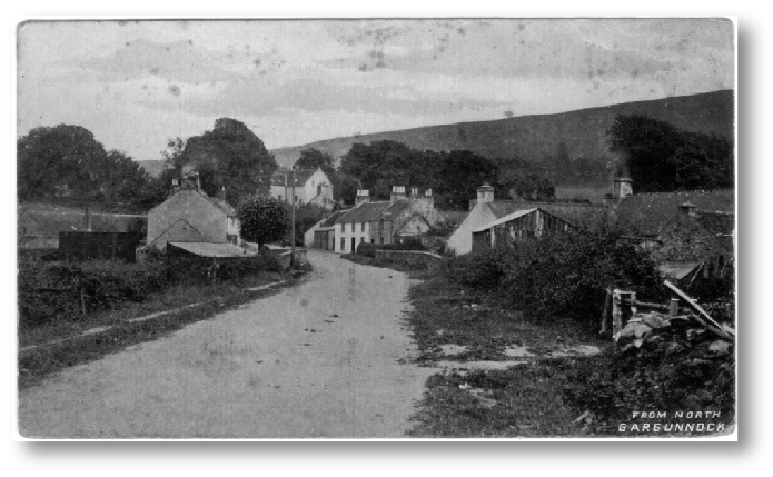
Leckie Road and the Square -
An unsurfaced Leckie Road is seen here leading into the village Square. No footpaths, just a track in the left hand verge leading along to the old, early 1800s bridge (replaced in 1964) The gable end to the left is McNair House. Across the road is Burnside Cottage, at that time single storey. The white building in the centre has its upper windows just touching the roof line. The roof had been raised by by the time of the painting of the Square dated 1917. The gable of the old Klondyke Cottage in what became the Rest Garden in the 1930s can be seen and In the distance the village church stands out plainly in its original yellow rendering.
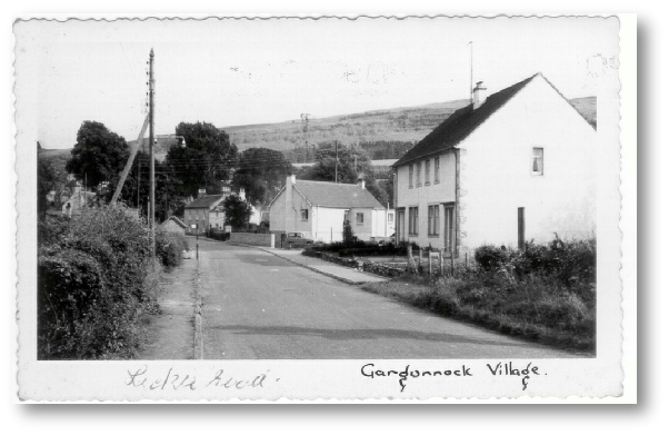
Leckie Road and the Square 1960s
Compare this more modern postcard with the previous postcard. Taken from a similar position but on the opposite side of the road in the late 1960s it shows great changes have taken place over the intervening 50 or so years which separate them. On the left a power pole carrying 5 wires signifies the coming of electricity to the village in 1939, with its attached street lamp from the late 1940s powered by an ordinary incandescent bulb. Beyond that a wooden bus shelter and bus stop are additions since buses appeared in the 1920s. The road is kerbed and surfaced now with a footpath on both sides apart from adjacent to the bottom of the pub (later the Gargunnock Inn) garden on the right.
In the Square the house now known as Kilmnana has had its roof raised and Burnside Cottage beside the new 1964 bridge is now 2 storeys in height. The small car beside it is a Hillman Husky. The church is now hidden from sight behind mature trees.
The block of council houses on the right is part of a small development in the 1960s which required the removal of old buildings on the north side of Main St from the bridge up to the house adjacent to the Inn
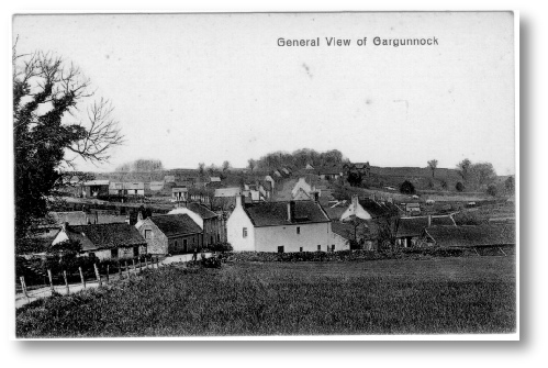
Village from the Glebe -
A general view of the village dated early 20th century taken from the high side of the Glebe or church land just down from Ladies Walk. Manse Brae can be seen on the left and the stone steps leading to the Boquhan enclosure are just visible. Beyond those the cottage known as Klondyke can be seen, later demolished in the 1930s when the Rest Garden was created. To the rear of Klondyke can be seen Burnbank Cottage sitting near the junction of the Gargunnock and Gala burns. At the right of Klondyke, across the road to the Mill Farm (now Millmuir) is Rhone Cottage, later a barn, stable, garage and now a dwelling house.
In the centre sits the White House with its long low Basket Shops to its right where oak spale baskets were made by the Travis family and local workers from mid 19th century through to the early 1930s.
Beyond that it can be seen that development of the village was essentially along both sides of the Main St with strips of land (or feus) extending north and south. Although the Main St at one time continued westwards, by this time it had long been a cul-
Courtesy of Doreen Harvie
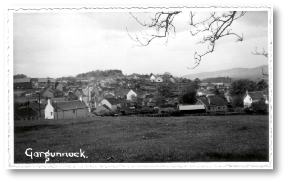
Village from the Glebe -
This next photo taken a little to the right of the previous one in the late 1960s shows a number of changes. The basket shops have all disappeared from the White House garden to facilitate a widening of Station Rd to accommodate vehicular traffic when buses began to appear. The owner of the White House, Miss McFeat, had by this time sold it and moved into the small Dorran bungalow to its right. It is believed that these deckle-
Power poles carrying electricity around the village are clearly in evidence while many of the houses on the south side of Main St have been removed as part of its redevelopment although Mrs Hunter’s old shop in Roseville is still seen. It was demolished in 1970. To the left of that many of the newly built McNeil Crescent houses are already occupied.
The village is no longer a ribbon development with McNeil Crescent, Stevenson St, Drummond place and Loftbrae schemes, all branching off Main St. filling many of the old feus with both Council and private houses.
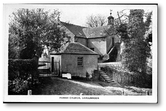
Gargunnock Parish Church from the Glebe
Understandably the Parish Church is a popular subject for postcards. The Session House is in the foreground with the date 1767 on its door lintel but 1774 on another above a gallery door. Beyond lies the church with its distinctive external stone stairs leading to the galleries, in this case the Gargunnock one below the belfry. The bell, originally rung from outside has for long been rung from just inside that door.
Although a bicentenary was celebrated in 1974 there is little proof that the church was actually rebuilt in 1774 rather than undergoing a substantial renovation. Church records are almost devoid of any reference to building work or to any interruptions to worship that would surely have occurred during a complete rebuild.
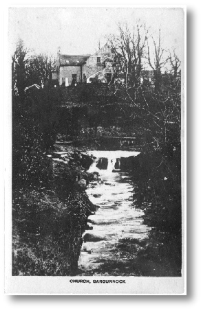
McGregor’s Lynn and the Church
A view taken from the front of Burnbank Cottage looking up the Gargunnock burn to the ford on the road to the Mill Farm and McGregor’s Lynn, probably so-
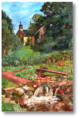
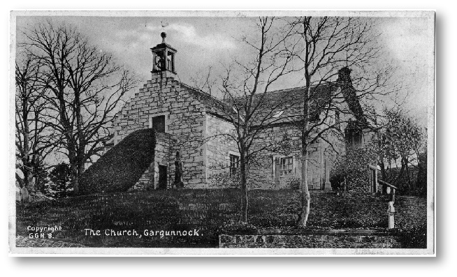
The Church from Manse Brae
Another view of the church from Manse Brae, exact date uncertain but certainly before 1928.
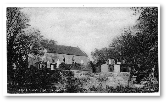
The Church from Duke St.
An unusual view of the rear of the church taken from what is now the lower graveyard but which at that time was Duke Street. Pre 1955
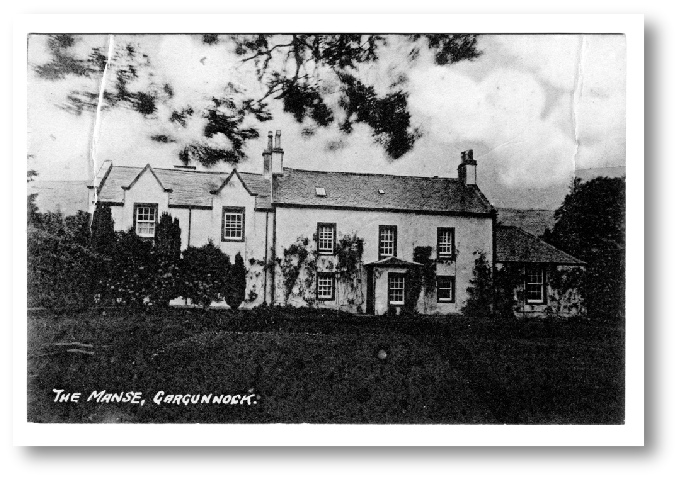
The Manse (Now Dinning House)
The Manse has been subject to enlargement since the early 1700s as it was originally too small for a married minister with family and servants. It was eventually sold in the 1960s and is now a private dwelling.
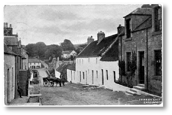
Main St. Looking East
Postmarked 1905 this view remained much the same until about 1960 except in detail.
The road is unsurfaced and remained so until the late 1930s. The house on the right was Mrs Hunter’s shop latterly although at that time probably Mrs McNaughton’s. Next was a “Model Lodging House where itinerant travellers could have a bed for the night and freshen up. The next 2 were dwelling houses while the third single story house was destined to become the Post Office although Mrs Binnie’s Post and Telegraph Office can be seen further down, just before Bridgend. A single telegraph pole can be seen outside it.
On the left is the “sheugh” or open stone-
The church in its coat of light yellow render is quite prominent in this photo.
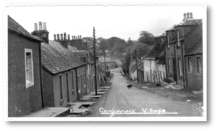
Main St, late 1950s
The row of houses on the south side of the Main St is still intact in this photo but were destined for removal within 12 years. The track visible in the road, running down to the right hand side of the bridge is that of the sewer laid not long before the photo was taken. The open drain or sheugh on the left is clearly visible, filled in by the late 1960s.
Power poles and telegraph poles are evident here but as yet no sign of TV aerials. The old dog belonged to Mrs Dewar across the road on the left.
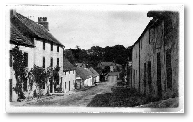
Main St and the Inn -
The lower part of the Main St is shown here with the Inn on the left run at that time by Jenny Coubrough who transferred it in turn to “Molly” Strang” who then ran it for 40+ years.
The first house past the Inn was later demolished and rebuilt in modern times. The rest of the houses were removed and replaced by the small George St. Redevelopment and any dated lintels from the old houses were incorporated in the new screen walls beside the new. To the rear of one of the old houses were made spale baskets by a man called Craik who had learnt the trade with the Travis’ at the White House, seen in the Square, but then branched out on his own. A small lane or “close” between two of the houses led to Leckie Road and a standing stone in the middle of its entrance served to prevent anyone taking a horse through. That stone now sits opposite the present shop and beside the village notice board.
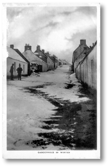
Main St looking uphill c 1900
No rock-
The second building up on the left, beyond the ruin, later became Miss Philp’s Post Office, although at this time it was still located just out of sight to the left in mrs Binnie’sd post Office.
Further on the rest of the houses on the left up to the head of the brae were later demolished in the 1960s to make way for the McNeil Crescent development.
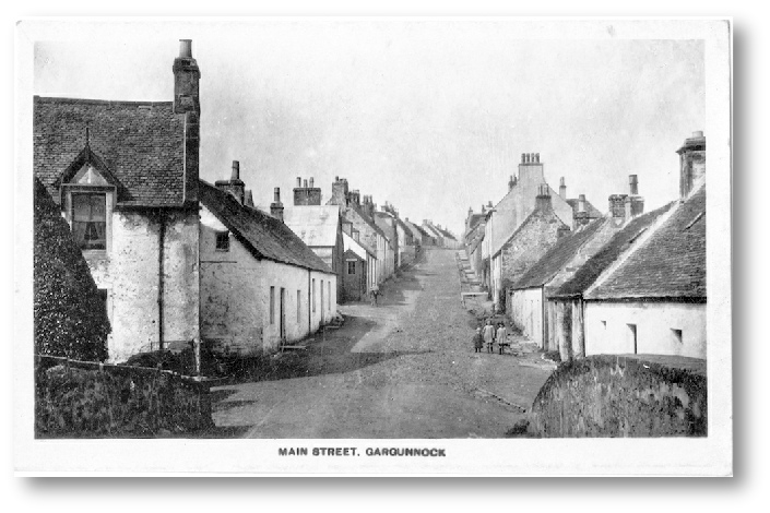
Main St from Bridge early 1900s
Slightly later in time than the previous one this postcard shows lots of interesting details. The building on the left is Bridgend, with its wrought iron bracket for a paraffin street lamp in use up to WWI. Beyond a block of two cottages, the first of which had been Mrs Binnie’s Post Office. By this time however the Post Officer had moved further up to another house to which a wooden porch entrance had been added.
On the right the second cottage was named Brenda Cottage, while the 4th was Craiks basket shop. The tall building is the 3 story Inn and the open sheugh and stepped footpath is plainly seen.
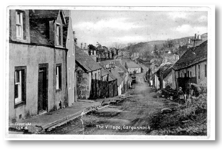
Main St looking downhill from Hillview, 1910 onwards
The house on the left, Hillview, was the home of the last “Provost” of Gargunnock. The one beyond, Strathview, unusually has four differently sized windows in the gable. Two doors further down was Elsie Boag’s shop for 40 years from the 1920s. The buildings on the right, known as the Sheiling or Razor Row are unusual in having an inclined roof line, something shared with the building opposite. The open sheugh is plainly seen here on the left and the road is an unsurfaced track.
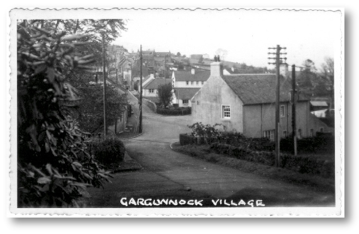
White House & the Square from Church 1960s
Seen from the steps of the church in Manse Brae the building in the foreground is the White House in the Square. Telegraph and power-
The village telephone box is still in the Square at this point and beyond the old drinking fountain, Burnside, old Mrs Pope’s house, is still single storey, later converted by her son Louis, a local builder. On the skyline the first houses in Loftbrae can be seen.
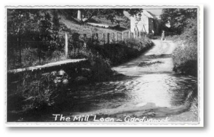
The Mill Loan and old Mill 1940s
The Gargunnock burn always ran over the Mill Loan at this point and the small footbridge on the left allowed pedestrians to keep their feet dry. Eventually, around 1960, the stone paving here was dug up and metal pipes installed. The pipes were surplus from the laying of an oil pipeline from Finnart to Grangemouth along the face of the hill. Sadly, for pedestrians, it didn’t work as each time the burn is in spate it overflows at this point and the wee bridge is no longer available. The old Mill, demolished around 1960, can be seen in the background, already propped up by timber
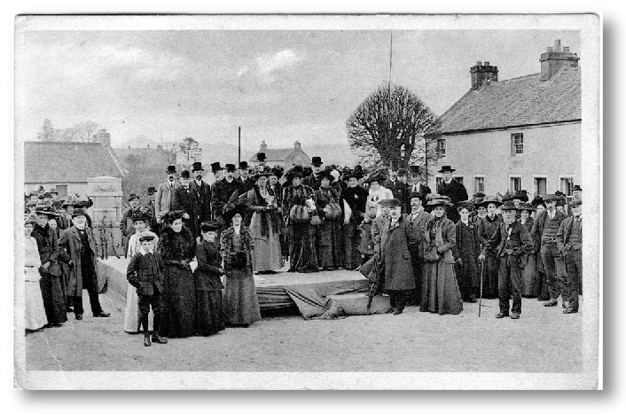
Inauguration of the new Piped Water Supply and Dedication of Drinking Fountain 1910
In 1910 a pipes water system, paid for by the Rev Robert Stevenson, was installed as was a drinking fountain in memory of his mother. This photo was taken at the dedication of the fountain to her memory. It was attended by the great and the good of the area and some from beyond as Stevenson was well connected.
When the water was turned on a hose shot water higher than the surrounding buildings which raised a great cheer.
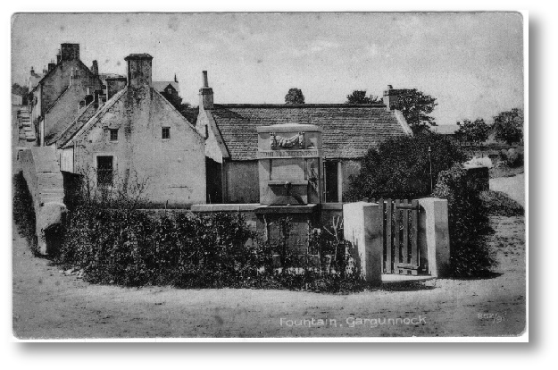
Drinking Fountain Gargunnock
This postcard, postmarked 10th October 1910, was sent only a few months after the installation of the first piped water supply to the village paid for by the minister, Rev. Robert Stevenson. At the same time the Rev Stevenson’s mother was commemorated by the installation of this drinking fountain paid for by her family.
On the left can be seen the northern parapet of the Main St. bridge and beyond that the steeply rising Main St with its stepped concrete footpath and open “sheugh” to drain the road surface water and rainwater from roofs down to the burn which passes between the drinking fountain and the houses behind. The building on the right is Burnside which was later, in the late 1950s/ early 60s enlarged by the addition of an upper storey. The one on the left was demolished around the same time. The wooden gate to the drinking fountain was eventually replaced by a wrought iron one. At the right hand side of the fountain a bronze drinking cup hangs on a chain but this disappeared in the 1960s. Note the earthen finish to the roads at this time.
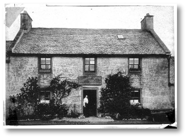
The Guest House -
This house in the Square, was constructed around 1800 by a John Murdoch, tenant farmer in the nearby Beild Farm, possibly in anticipation of his marriage. Later it became an Inn (Broon’s Pub) then was bought by the local minister Robert Stevenson, as a meeting place for the young men of the village. After that it became a Guest House and tea room then a dwelling house, retaining that name. It was later re-
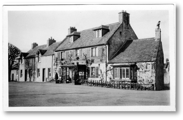
The Guest House 1930s
Later the Guest House took on a different appearance with rustic porch (from which Sunday papers were sold well into the 1950s) and green shutters beside windows. While the loft sp[ace was also developed. The two adjacent houses, McNair House and Glenfoyle Cottage, were constructed in 1830, initially as single storey buildings.
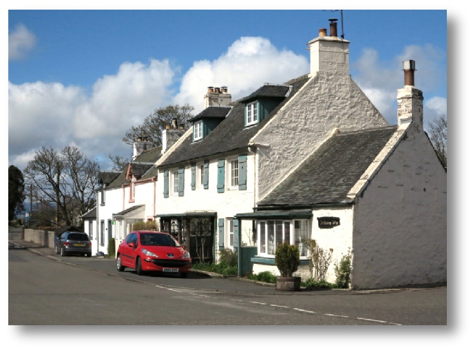
Trelawney Cottage -
The Guest House was later renamed Trelawney Cottage in the 1960s by a former owner, Gordon Matthews, who hailed from south west England. During his time here it was for a number of years the village Post Office, that being housed in the single-
During his time here in the early 2000s Ian McCallum wrote an excellent book entitled, “Gargunnock -
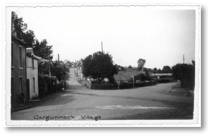
The Square 1950s
The telephone box still sits in the Square and the bus stops are located here outside the Guest House. In the roadway there are signs of the laying of sewers across the Square, carried out not long before.
On the right in the distance can be seen the long greenhouses of Willie Craik’s market garden in the feu of Oakdene, Main St.
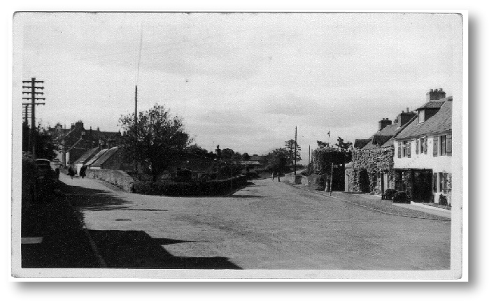
The Square 1940s
This is the Square in the late 1940s. Bunting is in evidence which suggests the month of June and Gala day Power poles also date it to after the late 1930s. Bus stops are visible, outside Glenfoyle Cottage and opposite. The old stone bridge in Leckie Road is still there as is the curiously shaped tree outside McNair House, removed when the bridge was later replaced in 1964.
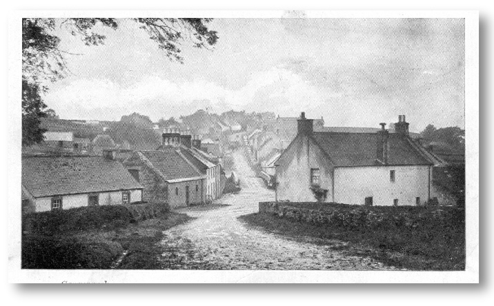
White House and the Square post 1917
On the left sits Klondyke Cottage in what is now the Rest Garden. Next Rhone Cottage with a door and 2 windows but also what appears to be a hay-
To the right, the White House, at that time home to the Travis’ basket making business which later closed in the early 1930s
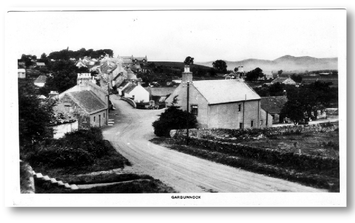
White House and the Square early 1920/30s
View from the church steps, the ones in the foreground lead to the Boquhan enclosure. The roads are unsurfaced and there are no kerbs in the Square. To the right of the White House, half of the spale basket shops have been demolished.
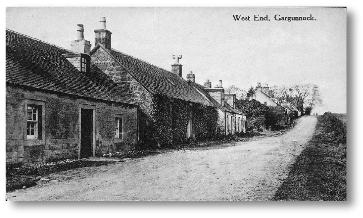
West End of Village Early 1900s
The least photographed end of the village is shown here with the three cottages, Haven Cottage, Briar Cottage and Rose Cottage. Beyond that a two storey building with external stone stairs was Drummond View from which Drummond Place was named.
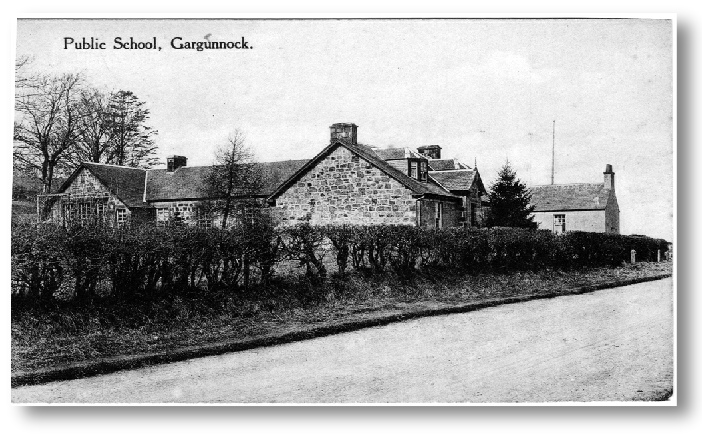
Gargunnock School
The School was opened in 1858 and replaced one at the top of the village in the house known as Carseview. Note the flagpole in the playing field beyond, only removed in the 1950s.
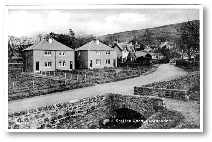
Station Road and Burnside
These local authority houses were the first to be built in Gargunnock in the late 1930s. The front gardens were quite long and the rear even longer in the manner of the times. In the foreground can be seen the containment of the burn by deep retaining walls. This deepening of the burn may date back to the 18th century when severe storms flooded out several cottages close by it.
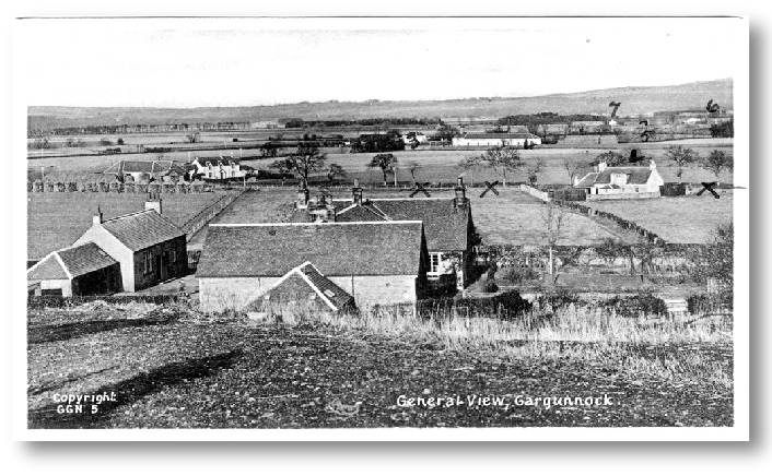
Gargunnock School from the South
This is one of a pack of postcards sent out to Tasmania in the 1920s then returned on the death of the recipient in the late 1980s. The markings relate to a written index on the rear of the card which shows the back of the school, the Fleuchams Farm on the left and Foot o’ Green Cottage on the right. Centre distance is the old distillery (4) and Dasherhead Farm (3).
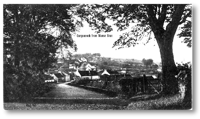
Gargunnock from Top of the Manse Brae
An old view from the top of Manse Brae opposite the entrance to the old Manse. On the right at the edge of the photo is the entrance to Ladies Walk.
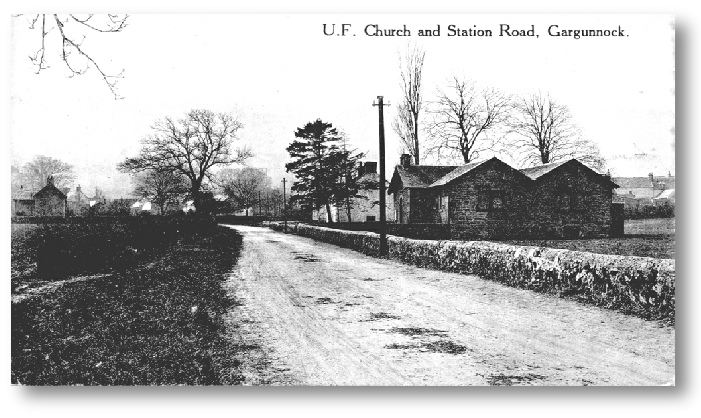
Station Road & the United Free Church
The only photo of the United Free Church in Station Road. It was a satellite station of the Free Church in Kippen but in the late 1930s was transferred to the Church of Scotland who had it converted into a Church Hall, largely financed by former minister the Rev Dr Robert Stevenson but also by public subscription. Note the horse droppings on the unsurfaced road. The hall was sold in the early 2000s and converted to a private dwelling. The poles carry telegraph messages to the Post Office in the village. The house on the left is the Lea. To the right can be seen the backs of some of the Main St houses.
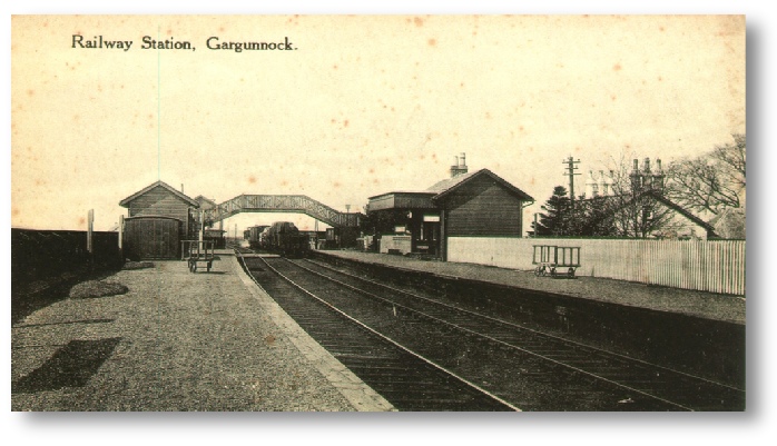
Gargunnock Railway Station
Built in the mid 1800s as a connection between the Fife coalfields and the Clyde the railway eventually became a victim of the buses which appeared in the early 20th century. It closed to passenger traffic in the mid 1930s and was permanently closed down and dismantled in the 1960s. During the early 1970s the signal box and most of the rest became victim of a Kirk Lane/Dumbarton Rd junction improvement. The platforms were made of wooden sleepers and the partial remains of the right hand one still exist, hidden behind trees and scrub vegetation. To the west of the Kirk Lane (its crossing of the lines can be seen just beyond the over-
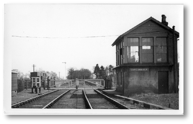
Gargunnock Station Signal Box
Not actually a postcard, just a photo but looks like it should be. I have only ever found 3 Station photos, one of them hung in the sawmill Portacabin office for years unknown to me. Thanks to Arthur Webster for telling me about it.
The photo pre-
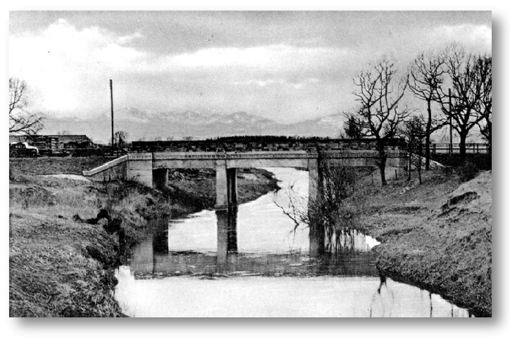
The New Offers Bridge mid 1930s
This bridge, built in 1934 replaced an earlier, rickety wooden bridge which in turn had replaced a suspension bridge which kept on falling down. It provided a much needed crossing of the Forth at this point, beside McLaren’s Sawmill and avoided a long journey round by Stirling or Coldoch.
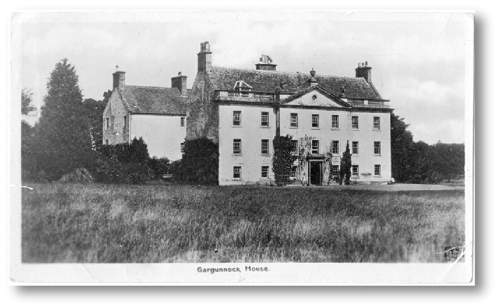
Gargunnock House
Early 20th century. Originally a tower house which evolved through various additions and extensions until the whole was given a more unified appearance by the addition of the Georgian facade in the late 1790s by Colonel Eidington who succeeded Sir James Campbell of Ardkinlass.
Eidington over extended himself financially in the early 1800s then sold out to the Stirling family, one of his principal creditors.
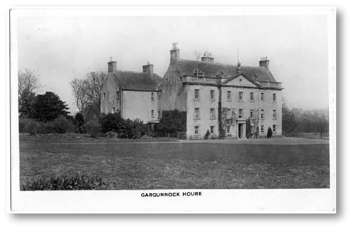
Gargunnock House
Another, earlier view of the house judging by the vegetation.
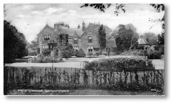
Meiklewood House early 1900s
This card is postmarked 1912, sent by Jean Blackie who was enjoying a stay here. Meiklewood house was constructed in the early 1800s and is a fine example of a Scottish Country House. Shielded by trees it has never been as prominent as Gargunnock or Leckie big houses.
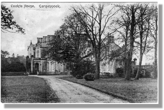
Postmarked 1908 and entitled Leckie House (its modern name, Watson House, was only applied after the 2nd World War) this name could well have been New Leckie house to distinguish it from Old Leckie or Leckie Castle which stands a short distance to the west. Old Leckie was never a castle of course, merely a typical 15th century country house.
At 78 years old it had settled nicely into the surrounding countryside and had just been purchased in 1906 by the Younger family who occupied it through to about 1940. Thereafter it became a military hospital, then then was purchased by the Church of Scotland to become the David Watson Eventide Home until that closed around the end of the century. It was then converted into luxury flats.
POSTCARDS
| History Bytes |
| Statistical Accounts |
| Church History |
| Local Magazines |
| Chronology |
| Parish Magazines |
| Kirkyard Monumental Inscriptions |
| Lower Graveyard Monumental Inscriptions |