

IMAGES GARGUNNOCK
Lately I have been working on old maps of the village and parish and in the process finding out even more about the history of land-

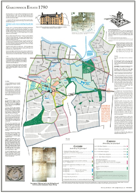
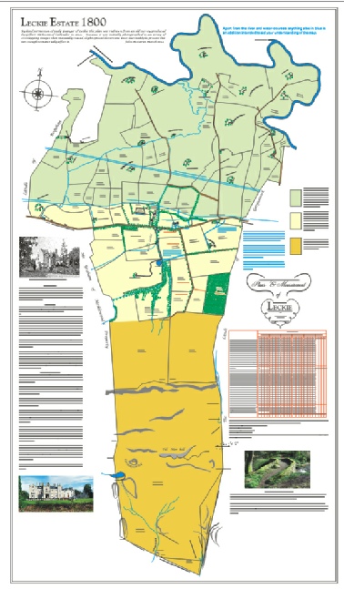
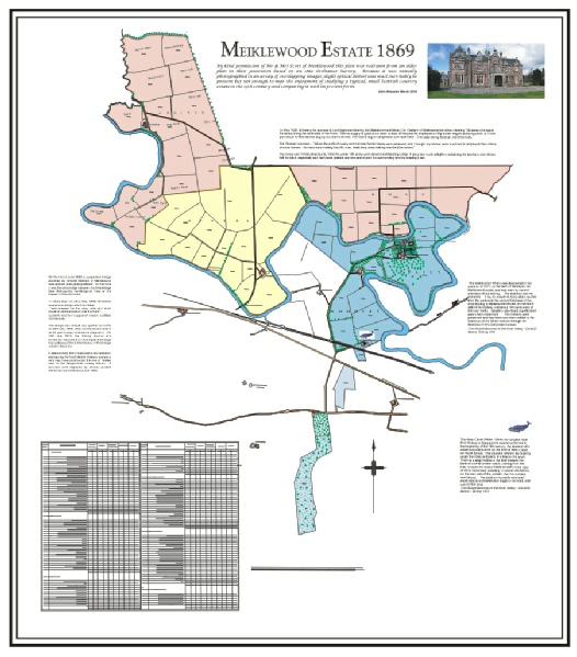
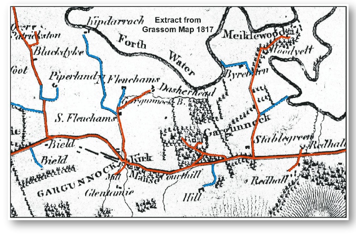
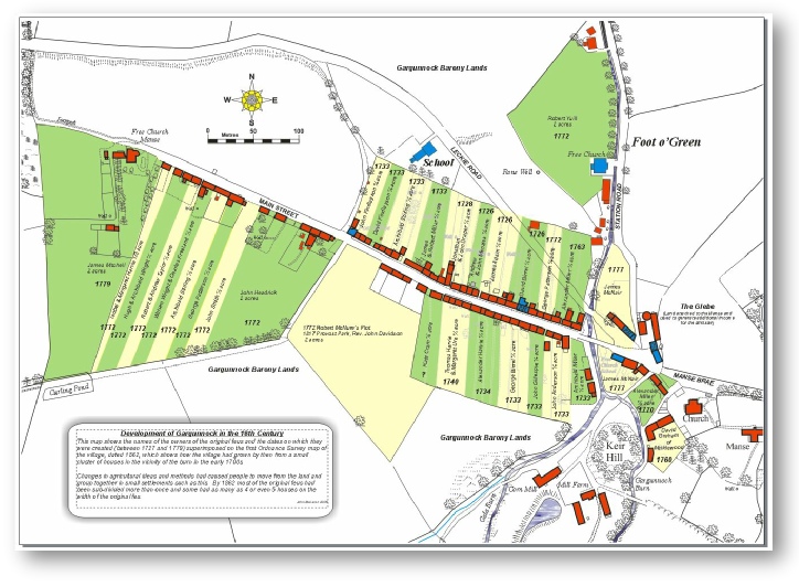
Gargunnock Estate Map 1790
The original of this map is ancient, with faded colours & delicate, discoloured paper. Securely and safely preserved in Stirling Council Archives perhaps but largely unknown.
Ancient it may be but it is crammed full of fascinating detail of what Gargunnock and its immediate surroundings were like 220 years ago. Roads where none exist now, farms long gone, clues as to land-
But look at this re-
I hope to finalise them then obtain permission to display and explain them in much more detail by the end of 2014 so please come back and check from time to time.
MAPS
| History Bytes |
| Statistical Accounts |
| Church History |
| Local Magazines |
| Chronology |
| Parish Magazines |
| Kirkyard Monumental Inscriptions |
| Lower Graveyard Monumental Inscriptions |